Geology/Watershed
Geology
Lava Flows
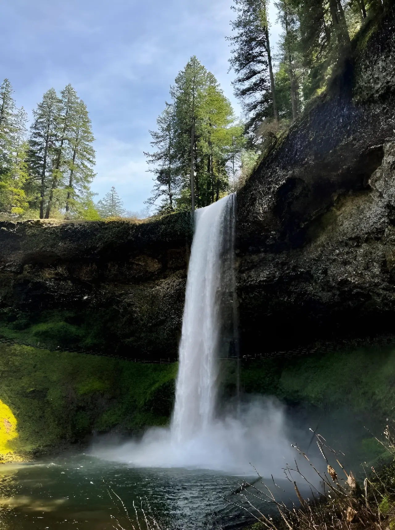
Lava and water have leading roles as the dominant forces of geologic change at what is now known as Silver Falls. The area was covered by a series of lava flows around 15 million years ago, and each drastically changed the landscape.
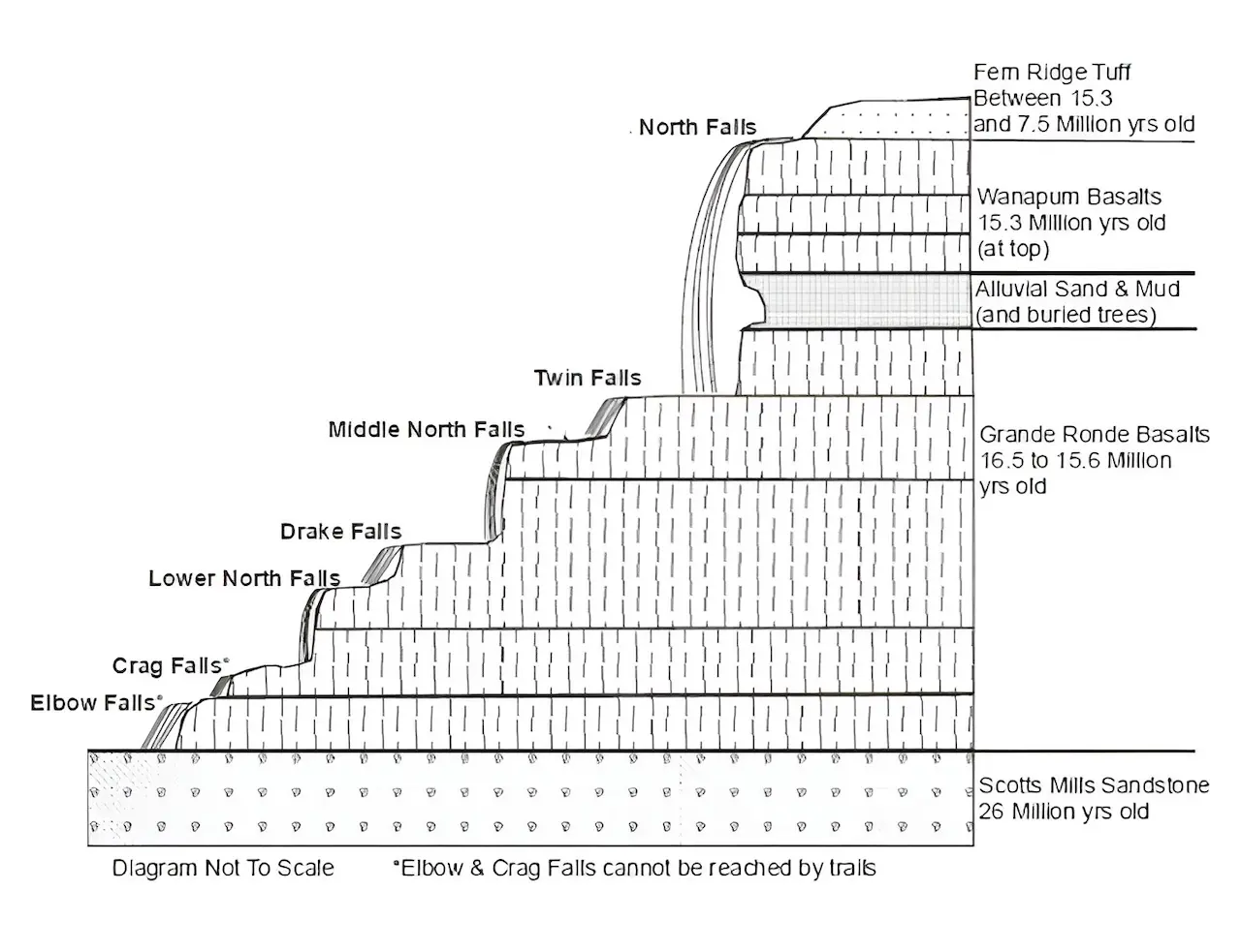
The black rock forming the cliffs at the waterfalls includes the Wanapum and Grande Ronde Basalts, part of a series of massive lava eruptions that are collectively known as the Columbia River Flood Basalts. During the period from 16.5 to 15.3 million years ago, the ancestral Cascade mountains had very few eruptions. Instead, the volcanic activity happened further east in Washington and Oregon, resulting in extremely thick basalt lava flows, the same kind of rock that forms at Hawaiian volcanoes today. Some of these lava flows followed the ancestral Columbia River Valley into the Silver Falls area. At least eight separate flows are exposed at Silver Falls.
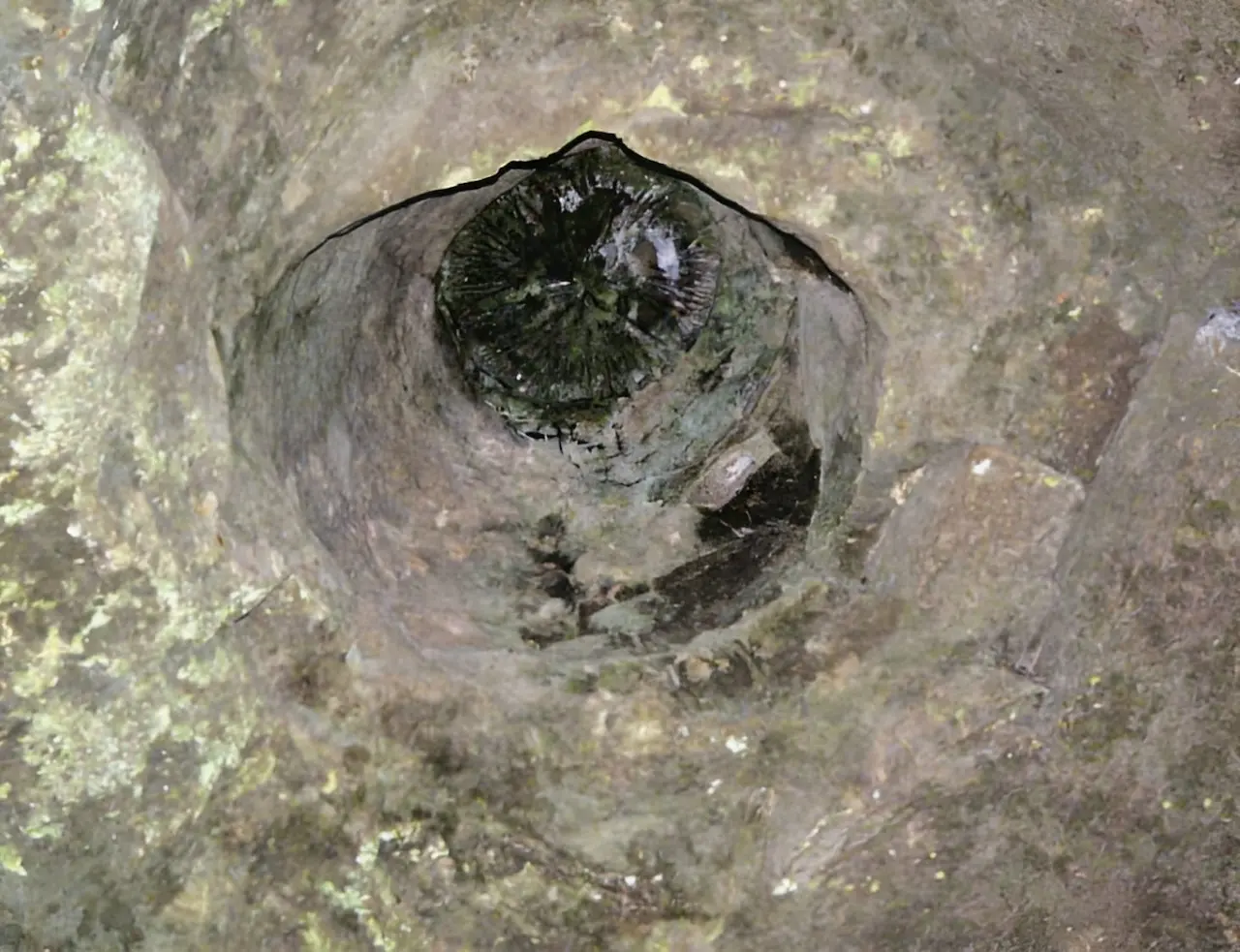
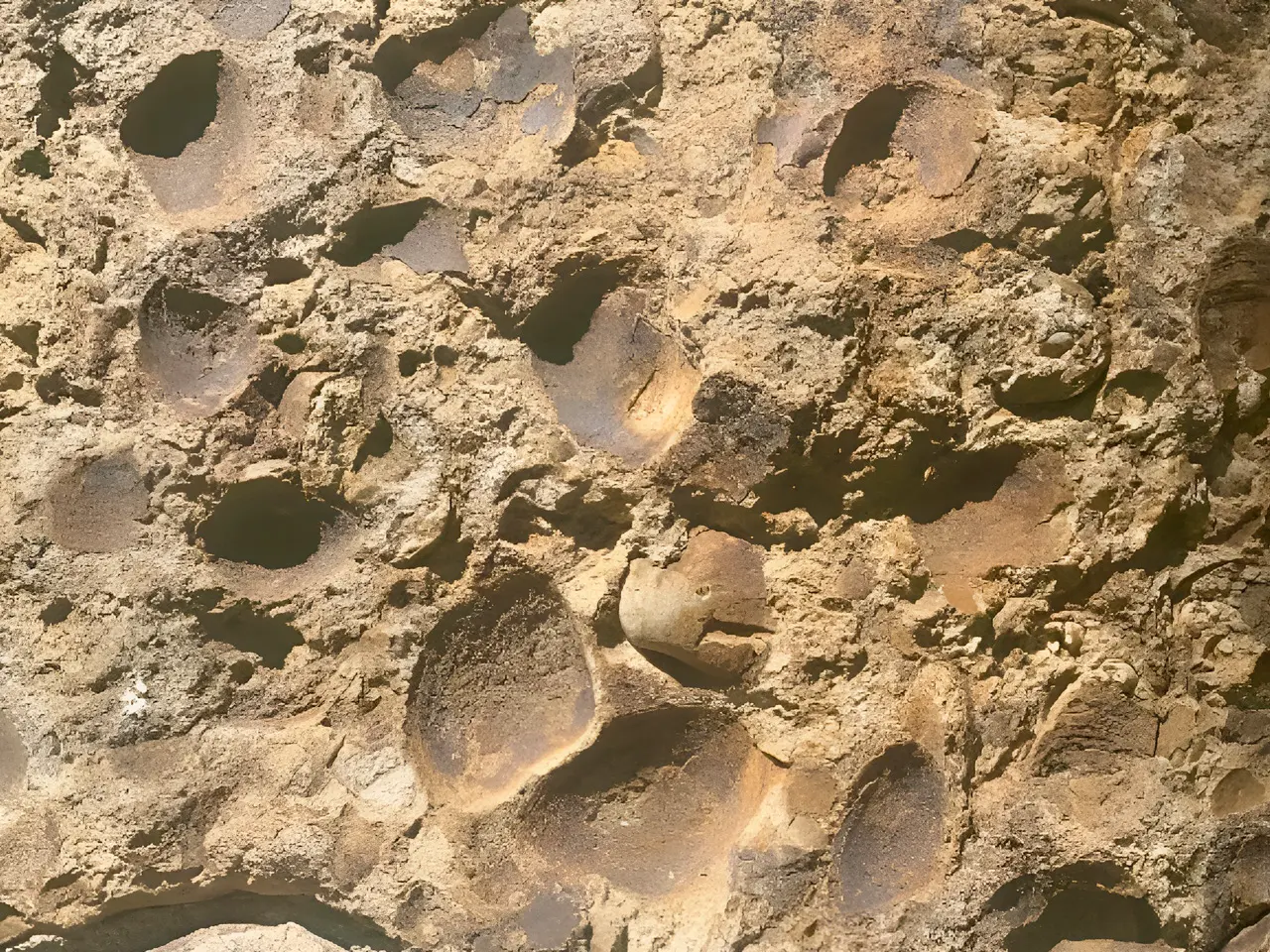
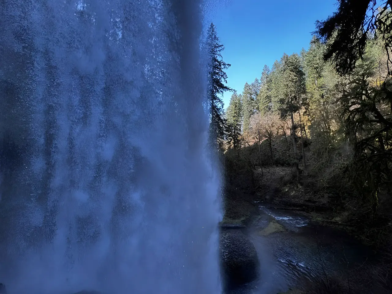
The amphitheater walkway at North Falls is in relatively soft sandstone and mudstone, sediments that were deposited by a stream between the basalt flows. A forest was able to grow on this sediment and was, in turn, buried by the next lava flow. In the North Falls amphitheater, you are walking in the root zone of this ancient forest. If you look up at the ceiling, you may notice round holes with blackened material inside them (a flashlight helps). That blackened material is the charred remains of the trees buried by that lava flow. This charred wood now forms a weak form of petrified wood that may rarely be found in the park. You may look for this petrified wood, but remember the park has a strict no-collecting policy regarding all of our rocks. We want to make sure our rocks are there to share with future visitors as well.
Fossils in the Stonework
Located in the South Falls Historic District
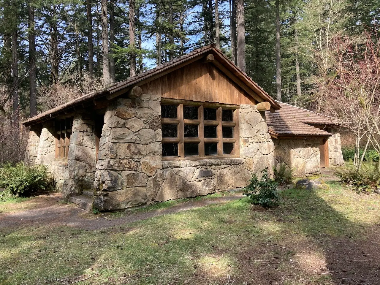
Below the layers of basalt in the park is sandstone from when the Silver Falls area was part of the Oregon coast. This rock only outcrops along Silver Creek in the very northwest portion of the park, an area that cannot currently be accessed by trails. This sandstone was, however, quarried by the Civilian Conservation Corps (CCC) to build the Stone Shelter in the South Falls day-use area. Feel free to visit the Stone Shelter and look at all of the marine fossils exposed in this rock.
The CCC built the walls, floor, and massive fireplace of the Stone Kitchen Shelter using stone from a local quarry. If you look closely, you can see shell fossils in the stone walls, physical remnants of the ocean floor that were here 26 million years ago.
Watershed
So, where does the water come from?
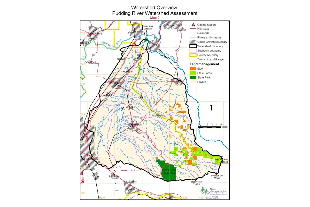
The headwaters of the North and South forks of Silver Creek are springs just outside the current park boundary. Several tributaries contribute before the confluence of these two forks.
- South Fork Silver Creek: South Falls, Lower South Falls
- North Fork Silver Creek: North Falls, Lower North Falls Middle North Falls, Upper North Falls, Drake Falls, Twin Falls
- Hult Creek: Double Falls
- Dry Creek: Winter Falls
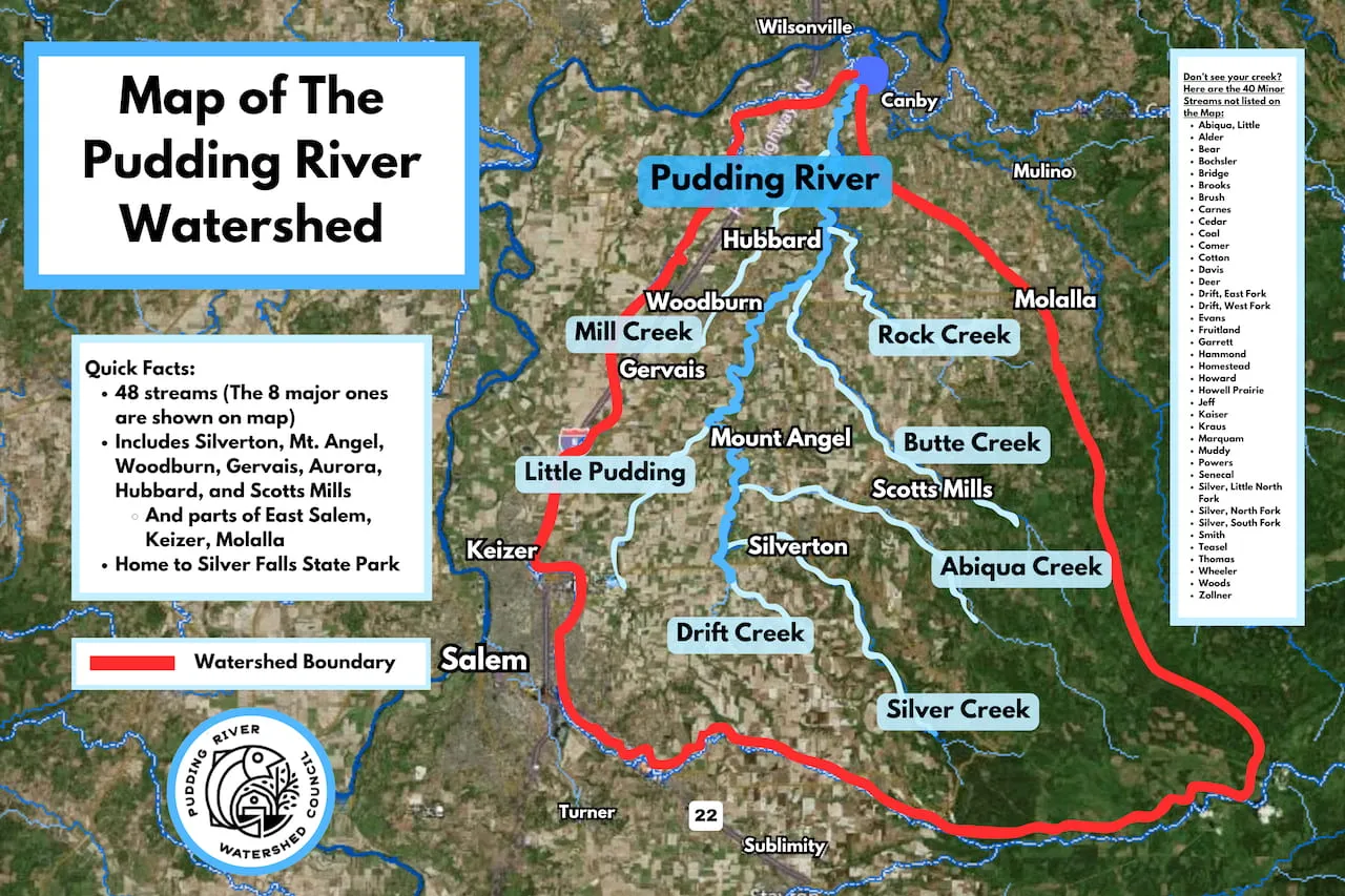
Silver Creek flows into the Pudding River just east of Silverton. The Silver Subbasin drainage covers 54.4 sqm and encompasses 10.3% of the Pudding River watershed.
Pudding River Watershed Council is a nonprofit organization that works to preserve and restore water quality and wildlife habitat throughout the region. Their 2023 survey found a decline in Coho, Steelhead, Chinook, and Trout in Silver Creek compared to 2014 levels. Read more about the surveys and how this informs future projects here:
These surveys were conducted downstream of Silver Falls State Park boundaries, meaning resident salmonid populations within the park or upstream of the Silverton Reservoir are not represented in this data.